Emergency UAV Response – Disaster Preparedness
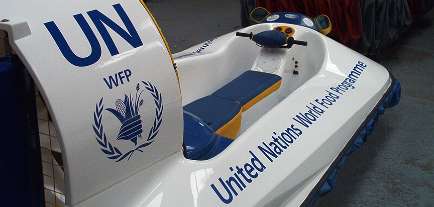
There are large remote areas prone to flooding, such as coastal regions that are difficult to monitor or manage after a disaster has occurred. Noice Industries has created the Emergency UAV Response Solution, operations that are specially designed to perform search, rescue and relief missions in mostly inaccessible disaster areas, floods and earthquakes.
Especially relevant to the conditions, the solution operates day and night in addition to operating in all weather.
The initial response to any disaster is critical in determining the success of the follow-up response. Immediate overhead imagery showing the impact of the disaster is critical in being able to inform the first responders, how to assist in the correct aid arriving as soon as possible.
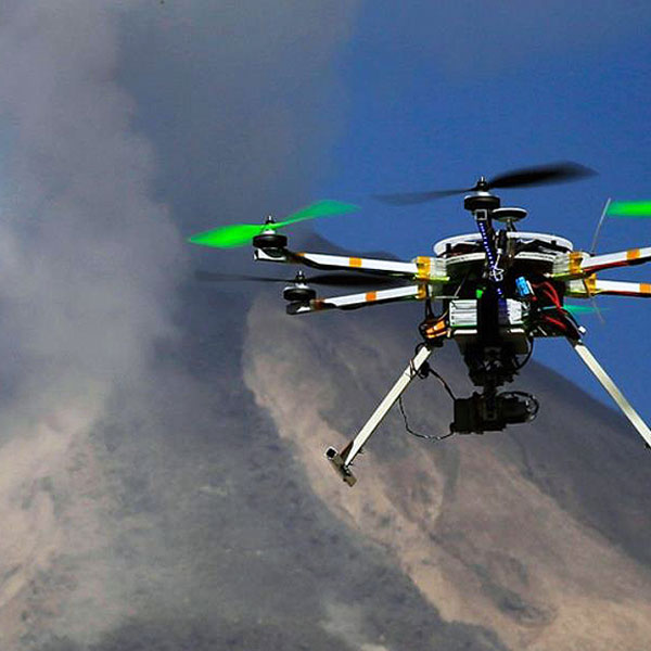
The Emergency UAV Response solution integrates multi-rotor drones, indoor collision resistant drones, fixed wing drones, tethered drones, hovercraft, EO/IR cameras. thermal imaging, sonar, communications, mobile command and control, therefore it provides actionable intelligence direct from the center of a disaster in real time.
The Emergency UAV Response Solution can be deployed from any terrain or amphibiously as opposed to traditional land-based systems, in addition receive a live video feed from the areas monitored by the drone, hovercraft, or static surveillance options. The system works with existing surveillance systems or comes with a fully operational command center.
Emergency UAV Response – Advantages
The system delivers increased visibility, therefore heightened awareness, while augmenting the ability to quickly respond or engage from the surface or from the air. Rather than a traditional disaster solution, boats, helicopters, trucks, we offer a unique a continuous and persistent mobile all-terrain and amphibious solution.
Getting into the interior of the disaster during flooding emergencies is difficult, garbage will float in the water and traditional rescue boat propellers easily get snagged and become immobilized. In addition, water jet in-take engines are also affected, hovercraft hover typically 9 inches above the surface and is therefore not affected.
While helicopters are expensive to operate, in addition 100 mph downdraft winds require a long winch cable which slows response times. Furthermore, when waters rise, victims climb trees and pylons, helicopters are less effective and cannot see victims under thick tree cover or operate near pylons.
Additionally, drones and hovercraft can also be outfitted with various sensor options that include visual, thermal, LiDAR, hyperspectral and multispectral. Why are these important? In earthquakes and landslides, these sensors can be flown to conduct ground truthing surveys. The thermal sensor, for example, is perfectly suited for detecting the heat a human body emits, which helps locate survivors. Various sensors suites are efficient in obtaining data to create an exact 3D reconstruction of disaster zones, which when compared with historical data from satellites, offers new perspectives on the extent of damage, and terrain or field deviation that could help manage future disasters.

Emergency UAV Response – Situational Awareness
Epiphany Pointer, our intelligent monitoring system, presents some of the most efficient and cost-effective solutions for operating in remote or harsh terrain challenging areas and monitoring disaster situation. Epiphany Pointer can distinguish between human and animal, target and track victims over vast landscapes. The system also tracks, coordinates and leads first responders to strategic response or engagement.
The WOKE (When Operators Know Everything) communication system, which is based on Ronin situational awareness solution, delivers the ability to process, evaluate, and disseminate sensor information (format, support equipment, etc.)
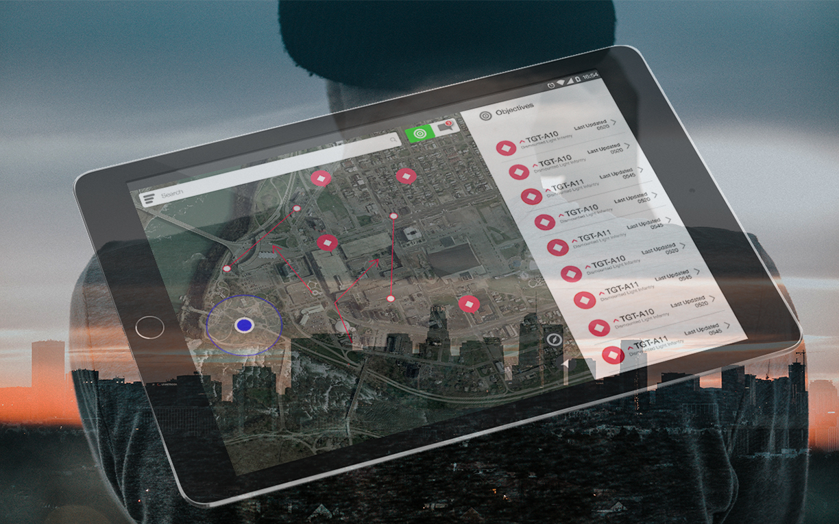
WOKE/Ronin would be used to take sensor and drone data and turn it into actionable intelligence. WOKE/Ronin gets that data into the hands of those who need it, in real time, to do their job better/faster/safer. Connect command center, drone pilots, and first responders to a single, common operational picture. Task, deploy, and monitor disaster response personnel and view their location and status on a GIS based dashboard.
The WOKE/Ronin Platform is a lightweight system that integrates legacy enterprise data and services into an application engine capable of creating situational awareness for the individual and providing a common operational picture for teams. Because of its roots in Military and Special Operations, WOKE/Ronin is also capable of working in some of the toughest conditions imaginable with any network such as tactical radio, SATCOM or even newer technologies like Ultra-Wideband (UWB). WOKE/Ronin is currently being used in multiple international border security scenarios.

Emergency UAV Response – Complete Solution
Turn actionable intelligence into situational awareness that a command center and agent in real time to respond better during operations. Provide applications to agents in the field on Getac devices or radios to enhance common operational picture.
The WOKE/Ronin Situation Awareness Platform ties existing systems and infrastructure together. It takes the data currently being collected and puts the right data in the right hands, so action can be taken in real-time.
The Emergency UAV Response solution also performs airspace UAV detection. RF Sensors are purpose-built for airspace security and collect hard data on drone activity in the airspace.
The Epiphany RedList auditing system keeps track of every facet of the operation in real time, reporting Geo location, UAV activities, first responder movement, incident tracking, pilot flight information, escalation, engagement. results, via text messaging, photo and video from the field
Epiphany Operations works as an enhancement of traditional physical security systems or as a stand alone solution. Our solutions are available through equipment purchase and lease, adding your personnel trained by us, autonomous solutions or as fully turnkey systems.


